What is ArcGIS

SECTION 1
What is ArcGIS?
Geographic Information Systems (GIS) have become an indispensable tool for understanding, analyzing and visualizing complex data sets. ArcGIS, one of the leaders in this field, is a geographic information systems software and technology package developed by Esri. Its name is an abbreviation of Geographic Information System, which means "Map Information System". 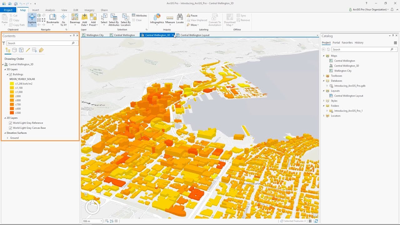 The main purpose of ArcGIS is to enable the collection, organization, analysis, visualization and sharing of geographic data. This software is designed to overcome various challenges in the world of geographic information systems and to offer users a powerful support in their geographic data analysis process.
ArcGIS Basic Components:
ArcMap and ArcGIS Pro: ArcGIS basically consists of two main desktop applications, ArcMap and ArcGIS Pro. ArcMap is a classic desktop application with a long history. It is mainly used for geographic data editing, map creation and basic analysis. ArcGIS Pro is a more modern desktop application and stands out in particular for 3D map creation, more complex analysis and a user-friendly interface.
ArcCatalog:
A tool for data management. It can perform tasks such as connecting to databases, creating geographic data sets and organizing this data. 
ArcToolbox:
It is a library that includes a set of tools for geographic analysis and data transformations. These tools are used to perform various operations on geographic data.
ArcGIS Online:
rovides a platform for sharing geographic data and online collaboration. Users can share their maps, create web applications and access ArcGIS's online resources. 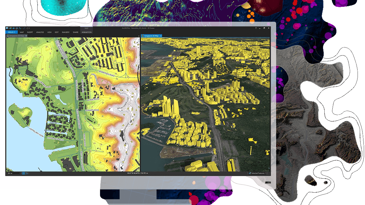
Powerful Features of ArcGIS:
Support for Various Data Formats: ArcGIS supports various geographic data formats such as vector and raster data. This gives users the flexibility to work on different data types.
Geographic Analysis Capabilities:
ArcGIS offers a wide range of analysis on geographic data. It can perform distance calculations, geographic queries, area-based analysis and more. 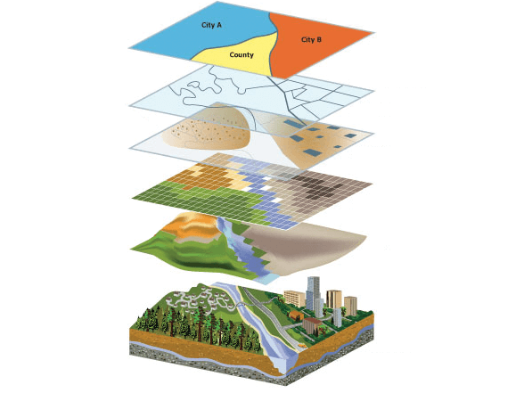
Map Creation and Visualization:
Users can create customizable maps representing geographic data and visualize these maps in detail. Comprehensive Training and Support: ArcGIS provides its users with a variety of training resources and support materials. This helps users use the platform more effectively.
ArcGIS is widely used in many industries, facilitating geographic data analysis and map creation processes with the comprehensive tools and features it provides in the world of geographic information systems. Exploring the potential offered by this software is an indispensable step for those who want to achieve success in projects related to geographic information systems.
-----------------------------------------------------------
SECTION 2
Data Organization and Analysis Processes with ArcGIS:
One of the key features of ArcGIS is the tools it provides for effectively organizing and analyzing geographic data. In this section, we will explore the powerful data organization and analysis capabilities ArcGIS offers.
Data Editing:
ArcGIS offers its users a wide flexibility in geographic data editing. Through ArcMap or ArcGIS Pro, users can edit data contained in geodatabases, shapefiles, or other data formats. Operations such as connecting to databases, creating new data sets, updating or deleting existing data can be easily performed. ArcGIS's data editing capabilities include features such as tracking, undoing and saving changes made to geographic data. This ensures that users working in a team have access to up-to-date and accurate data. 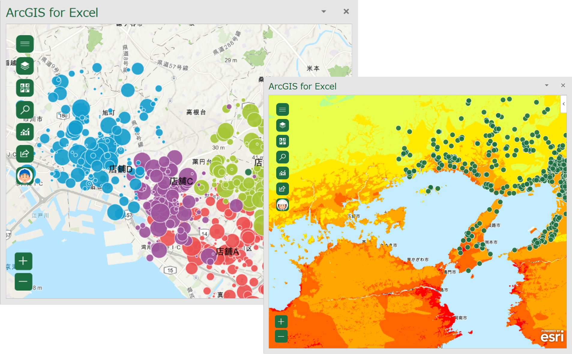 Geographic Analysis:
ArcGIS offers a wide range of analysis on geographic data. Users can perform a variety of operations, starting from distance and area calculations to more complex geographic analysis. For example, an urban planner can use ArcGIS to analyze the population density in a given area and create strategies for future development projects. Likewise, natural resource management experts can use ArcGIS tools to assess habitat diversity in forest areas and develop strategies for sustainability. Geospatial analysis capabilities can also be used in emergency management, water resource planning, climate change impact assessment, and more. These data organization and analysis capabilities offered by ArcGIS enable users to work more effectively and information-oriented with geographic data. In every sector, these powerful tools provided by geographic information systems allow strategic decisions to be made better and projects to be managed more successfully. Forest Fire Risk Analysis
-------------------------------------------------------
SECTION 3
ArcGIS and Sectoral Applications
ArcGIS has a wide range of applications in many sectors and serves as a powerful tool to optimize the use of geographic information systems in various industries. In this section, we will focus on the impressive role of ArcGIS in sectoral applications.
Urban Planning and Management:
Using ArcGIS, urban planners can analyze the growth trends of cities, plan infrastructure projects, and create urban regeneration strategies. Geospatial analysis tools play an important role in setting cities' sustainability goals and improving livability. 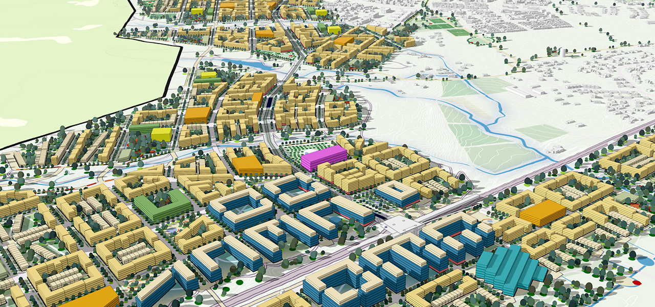
Energy Sector:
Using ArcGIS, energy companies can manage their energy infrastructure, assess solar and wind energy potential, and optimize energy transmission lines. Geographic data analysis guides energy companies to increase their efficiency and develop sustainable energy solutions.
Natural Resource Management:
Specialists in the field of natural resource management, such as forestry, water resources management, mining, etc., can plan the sustainable use of natural resources, monitor ecosystems and assess environmental impacts with ArcGIS tools. 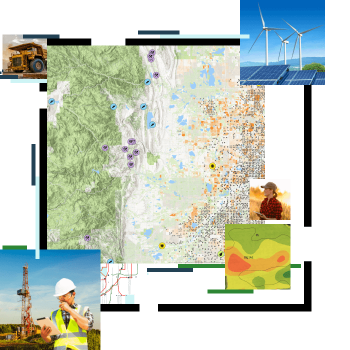
Healthcare Sector:
With ArcGIS, health analysts and experts can track disease spread, assess healthcare access, and develop strategies to combat epidemics. Geographic analysis makes decision-making processes in the health sector information-driven.
The features provided by ArcGIS in each sector are designed to adapt to sector-specific needs. In this way, users can customize geographic data analysis and map creation processes according to their industry requirements. ArcGIS is a powerful tool for optimizing information-driven decision making in sectoral applications.
-------------------------------------------------------------
SECTION 4
Conclusion: The Power of Geographic Information Systems with ArcGIS
ArcGIS stands out as a tool with a unique and powerful position in the world of geographic information systems. In this article, we examined the basic components of ArcGIS, its data organization and analysis capabilities, and explored application examples in different sectors. ArcGIS is used in many fields from urban planning to energy sector, from natural resource management to health sector. With its ability to adapt to sector-specific requirements, user-friendly interfaces and extensive training resources, ArcGIS offers users powerful support in geographic data analysis and map creation processes. With the ever-evolving technology, the ArcGIS platform is constantly updated and innovative features are added. This allows users to use geographic information systems more effectively and manage their projects more successfully. These comprehensive capabilities that ArcGIS offers enable geographic information systems to respond more effectively to future challenges. Using ArcGIS' powerful analysis tools and data organization features, users can make their projects in various industries more sustainable and information-driven. In conclusion, ArcGIS has an important role in the world of geographic information systems by making geographic data analysis and map creation processes more efficient, effective and powerful. This software provides its users with a tool that helps them better understand geographic information and improve their decision-making processes.
Thanks for reading and patience